Once you’ve bought or borrowed everything necessary to hike the Bibbulmun Track, the next thing is to plan your walk. I created a spreadsheet which recorded, for each date, the starting and finishing points and the number of kilometres between them. This is useful for working out how much food you will need for each section and for arranging to meet other people. I tried to allow at least one rest day in each town to stock up on supplies, do my washing, shower, eat and, most importantly, rest.
Transport
If you’re walking the whole Track in one go, transport is not an issue – you can catch a bus from Perth to the northern terminus of the Track in Kalamunda, and get a bus back from Albany when you arrive at the southern terminus a month or two later (or vice versa if you’re walking from south to north).
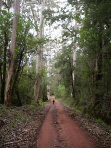 If you’re only walking a section of the Track, planning a walk can be trickier as vehicular access points and public transport are limited. Most of the towns on the Bibbulmun Track are serviced by buses, but they are infrequent and may need to be booked in advance. This isn’t a problem on the outward journey, but on the way back it may be difficult to predict what time (or even what day) you’ll reach a town on foot. If you have a car, you can drive to an accessible place on the Track, walk to a certain point then retrace your steps back to the car. If you’re not walking alone and have two cars at your disposal, a good strategy is to park a car at each end of the section. There are also taxi services and tour operators who can help you to co-ordinate your walk, and some B&Bs near the Track offer drop-off and pick-up services. More information can be found in an accommodation and services guide for walkers published by the Friends of the Bibbulmun Track.
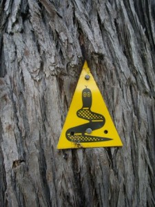
The Bibbulmun Track passes through some remote areas of Western Australia, so once you’re on the Track you need to know how to stay on it. Distinctive yellow triangles displaying a waugal symbol (a rainbow serpent spirit-being from the Aboriginal Dreaming) are nailed to trees along the way to mark the Track. It is important to keep an eye out for these waugals, as you can easily stray off track if you’re daydreaming. I speak from experience – many times I’ve wearily had to retrace my steps to look for a waugal. As a rough guide, there should be five waugals per kilometre in forest areas, and two per kilometre in more open areas. On long walks, maps are essential and a compass comes in handy. If you’re more tech-savvy than me, a GPS could also be invaluable, though you’ll need to take a solar charger too as there are no power points between towns.
The camp sites
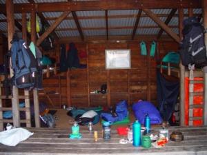
As I mentio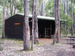 ned in the last blog, there are 48 campsites on the Bibbulmun Track. Besides a 5,000-litre rain water tank, each campsite has a sturdy three-sided timber hut with a tin roof, a bush toilet, tent sites, and a picnic table. Many campsites also have a fireplace, but between October and May fires are banned or restricted. Each hut can accommodate between eight and 15 people (depending on the design) sleeping on wooden boards. There is no charge for accommodation and it can’t be pre-booked, so if you’re hiking for a long time or overnighting during a busy period (e.g. a long weekend) it’s best to take a tent with you.
Safety first
Although walking is a relatively safe pastime, there are hazards associated with the bush. If you’re walking alone, make sure someone knows your itinerary and sign the registers found in each hut. People also record their experiences in these registers so, as well as being a safety precaution, they are a useful source of Track intelligence about such things as: missing markers; the condition of the Track; the state of the water supply at the next campsite; big hills en route; flora and fauna to look out for; or the school party that took over the campsite the day before. For example, I discovered from the registers that the Track markers on the Monadnocks (a series of exposed 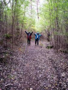 rocky hills) were piles of rocks instead of the usual waugals. This saved me a lot of stress wondering whether I was on the right track in the absence of waugals.
Just do it!
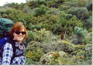 Whether you want to walk for a couple of hours or a couple of months, the Bibbulmun Track provides the means to get away from it all and to experience the peace and beauty of south-west Australia. But be warned, this is not a stroll in the park. The Bibbulmun Track can be tough so, go on … take a walk on the wild side!
Sounds beautiful. Sounds hard, but rewarding. You give such good and practical advice.
LikeLiked by 1 person
Thanks, Mary. I can remember what I would have liked to know before I hiked it!
LikeLiked by 1 person